
Helping Sustain our Village Community + Working Creatively to Tackle the Challenge of Climate Change
A History of Windmill Hill, Ilmington

Introduction
In the September of this year the field on the SW corner of Windmill hill was ploughed and sown with cereal. After weathering, the field surface was clear for fieldwalking and this was carried out in November with permission from Rob & Carol Hawkins. This part of the hill has been in pasture for at least 30 years and so this was an opportunity to add information to the known archaeological features of the hill; the Romano-British farm site on the top (Carey, 2014) and the site of the windmill which gave its name to the hill and to bring accumulated finds up to date.
The pottery found in 2020 was largely post-medieval (1450-1750), indicating that this field was still being ploughed and manured with midden material containing pottery after the Black Death and population decline of the mid14th C which, in turn, led to many other fields in this area being grassed over for sheep (Dyer 2012). The lack of Victorian pottery indicates that it remained grassed after being enclosed by hedges in 1781 and staid so until post WWII.
Location and Landscape Setting
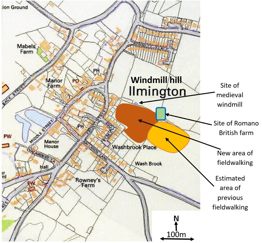
Fig 1 Location of area of fieldwalking and archaeological sites on Windmill Hill
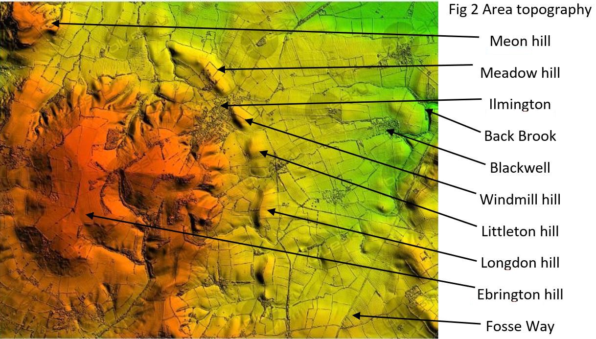
Windmill hill along with Meadow hill to the north west and Littleton hill to the south originated in glacial dumping from the Anglian Ice Age (450,000 years ago) that finished with a terminal moraine at Moreton in Marsh and a glacial lake that became the Stour Valley (Millward & Robinson 1971). Much of the hill was brought down by ice from the Yorkshire and Lincolnshire Wolds and so has a natural high chalk and flint content that makes fieldwalking for pottery difficult. Spring fed streams, originating in the limestone of Ebrington hill above Ilmington, have cut down through these soft glacial deposits to create a chain of small hills and these form the basin within which Ilmington sits. The streams flow mainly eastwards to become the Back Brook in Blackwell and join the Stour just north of Tredington.
Archaeological Background: The Windmill
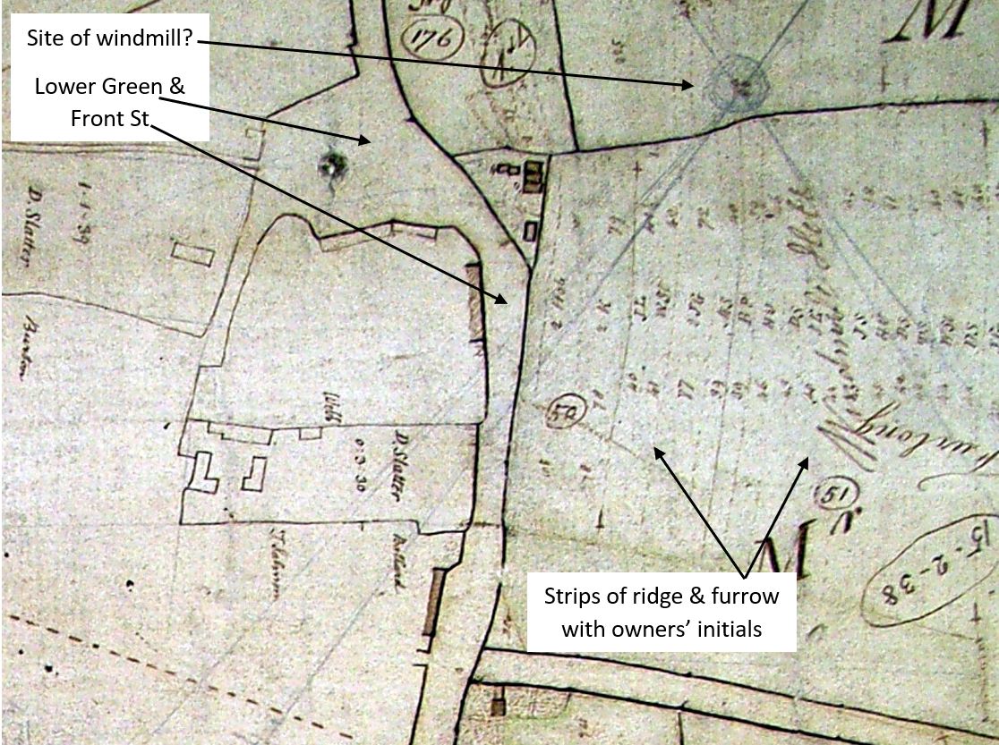
Fig 4 Part of Ilmington’s enclosure map of 1781 showing the surveyor’s use of the windmill site for the construction of the map (projected pencil lines) and various owners’ initials on strips of land before they became enclosed.
The windmill site’s existence has been assumed from documentary evidence such as fig 4 (Shakespeare Birthplace Trust). Gardner & Ibbotson (1974) mention a windmill as part of the manor in 1564 and again in 1610 but by 1781 it is drawn as a site rather than a mill. In between these dates was the civil war of 1642-6. The site lies just outside the area that had been ploughed in September, but as many musket balls have been metal detected in this area (fig 18), and it is a naturally advantageous high-point in the village, it was thought that it may have contained evidence of the known skirmishes and looting events that took place in Ilmington during the civil war (Tennant 1996). The detectorists only scanned the south side of the hill and did not record any locations for their finds. It was hoped that fieldwalking this area may provide evidence of the mill.
The Romano-British Farm
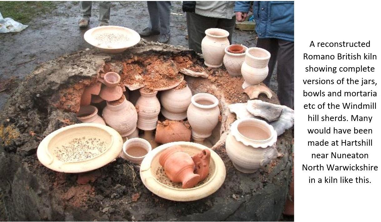
Peter Gardner first identified an Iron Age/Romano-British site when fieldwalking the SE side of the hill in 1974 (orange area in fig 1). Iron Age farmers from the 1st C BC continued at this location on into the 4th C AD of the Roman period as shown by the 141 pottery sherds that Peter found and were then analysed by Paul Booth at Warwick Museum (Booth 1987). In subsequent years the author and members of Archaeology Warwickshire have added to this assembly while carrying out a geophysical survey in 2014.
Fig 5 The results of the geophysical survey and its interpretation.
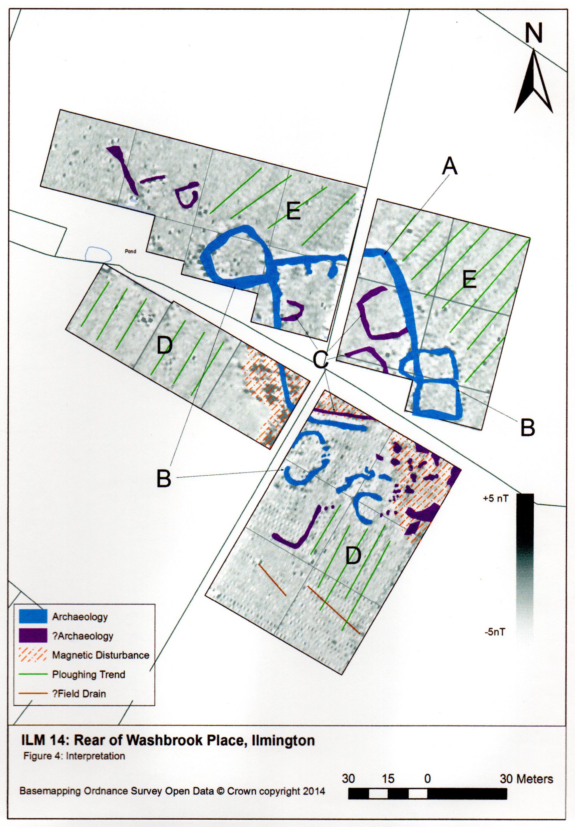
Geophysics results showing the ditches (in blue A & B) enclosing the Iron Age/Romano-British farm on Windmill Hill, Ilmington. Green D & E = medieval ploughing marks.
This survey detected ditches enclosing a typical Iron Age / Romano British farm on the flat top of Windmill hill - Fig 5 (Carey 2014). The main site is enclosed by a sub rectangular ditch approximately 65m by 50m which is about the size of the Crow Yard allotments opposite Ilmington village hall. This would not have been a ditch as we think of field ditches today but would have been considerably larger at least 3m wide and 2-3m deep. It is surrounded by other smaller enclosures both circular and rectangular that might be expected of the extended family farm that, judging by the evidence of the finds (see below), existed from the Iron Age period until the late 4thC AD. A period of at least 400 years, although it is not possible to say if this was continuous. Some of the
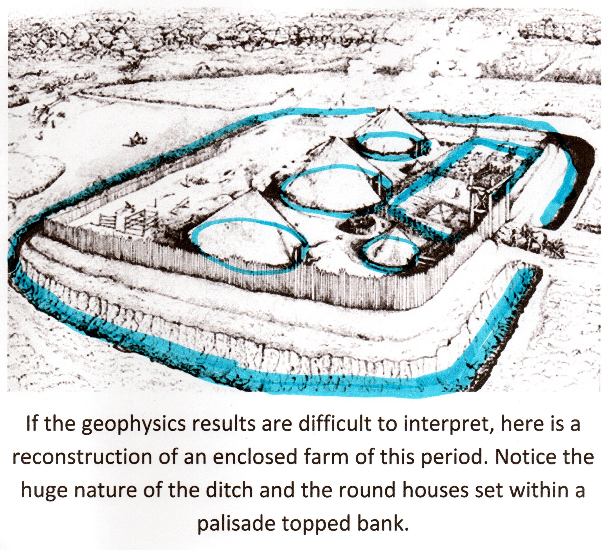
If the geophysics results are difficult to interpret, here is a reconstruction of an enclosed farm of this period. Notice the huge nature of the ditch and the round houses set within a palisade topped bank.
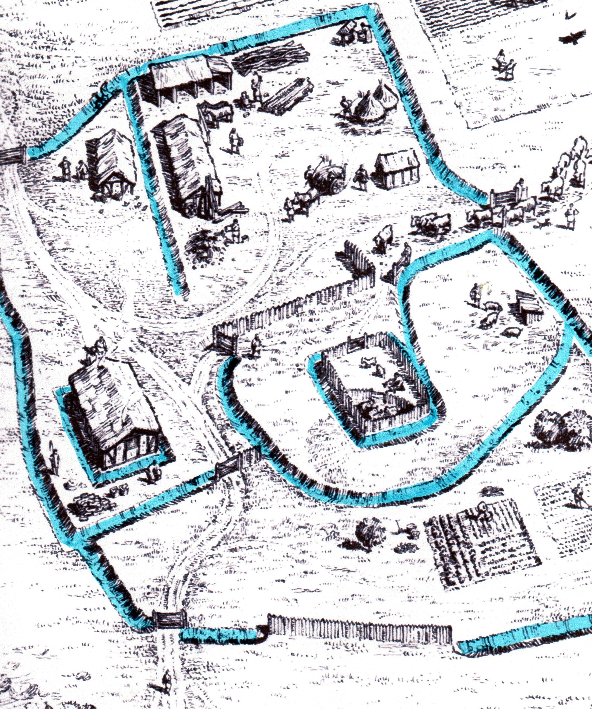
The 1st century BC site (top) will have had new changes by the later 4th C AD Roman period (above), and the magnetometry would combine these with the earlier ones to give a mixed plan.
small circles in fig 5 may be the drip gullies that carried water away from the wattle and daub walls of round houses. This is the first evidence for people living and settling in this area and it, with other extended family farms at Mansell Farm and Upper Larkstoke, undoubtedly provided a focus for further occupation that ultimately became Ilmington village much later towards the end of the Anglo-Saxon period, probably in the 9-10th C (Blair 2018).
Artefacts from the Farm Site; The Iron Age Period 600 – 0 BC
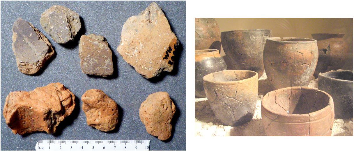
Fig 6, Left upper row: four, thick Iron Age pot sherd from the site, lower row; daub fragments possibly from round-house wattle walls.
Right: complete Iron Age pots (not from Ilmington)
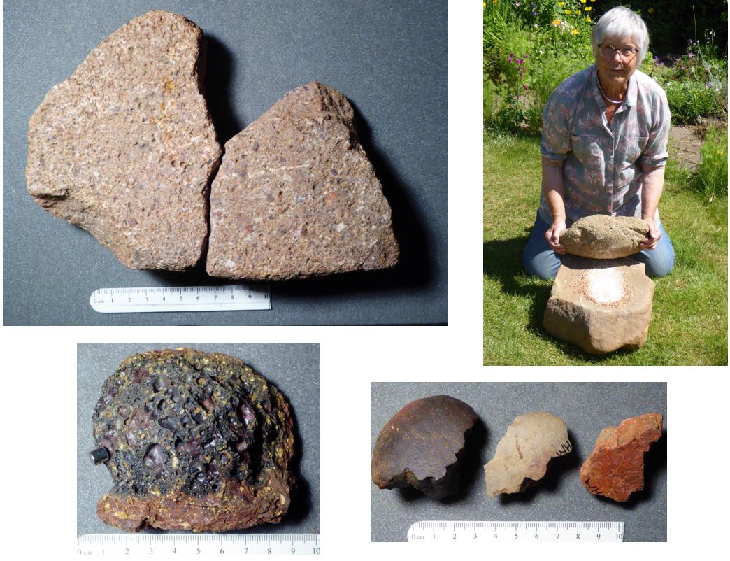
Fig 7 Top row: quern fragments from the site, right, using a quern to grind grain.
Bottom row: iron making slag with a tiny cylindrical magnet on left & three heat cracked cooking stones.
The farmers living in the Iron Age farm would have been members of the Dobunni tribe, centred in the Severn Valley, and it was they who made the pottery and wattle daub in fig 6. The pottery (top row) is hand-made from clay coils to make the bucket-shaped pots shown in fig 6 (right) and the daub is the clay/straw/cow manure mix used to seal the wattle walls of round-houses. This rarely survives as it is basically dried mud. So the fragments in fig 6 are possibly the daub used for a baking oven, the heat from which hardened the clay enough for it to survive.
The iron-making slag reacts to magnets (fig 7), indicating that iron is still present in the slag as the techniques of the period did not melt the iron cleanly. It had to have additional hammering making it into wrought iron. Iron making was not unique to this period and continued being made locally into medieval times, but it is interesting that such slag has also been found by the author at the other Iron Age / Romano British farm sites of Upper and Lower Larkstoke. The iron ore most likely came from the Forest of Dean in the Dobunni tribal zone (Moore 2006).
Also, from the Forest of Dean, came two quern fragments that were parts of a much larger saddle quern used with a rubbing stone to grind grain (fig 7 upper row). The pieces are made of a distinctive type of Old Red Sandstone that comes from May Hill in the Forest of Dean and is another example of Dobunni trading with other Dobunni bands within the tribe. By the Roman period rotary querns rather than the simple saddle quern, were in use. One of these was found by Peter Gardner in a garden wall at Washbrook Place at the foot of Windmill hill. Both saddle and rotary quern fragments have also been found at the Romano British farms at Upper and Lower Larkstoke and on Meon Hill (Moore 2006).
The final piece of evidence of Iron Age settlement is that of the heat cracked stones (fig 7 lower right). These have jagged fractures diagnostic of them (nice smooth quartzite pebbles) having been heated in a fire and dropped into water or stews contained in the rather badly made Iron Age pottery. This pottery was fired at low temperatures and could not cope with direct heating on a cooking fire. Instead, the hot stones were heated & transferred their heat to the liquid in the pot or in a wooden bowl. Again, similar stones have been found by the author at other Iron Age / Romano British sites in our area (fig 13). Their use continued into the Roman period so the impression from all these sites is that of continuity rather than abandonment of the sites when the Romans arrived.
When Paul Booth (1987) analysed the original 141 pieces of Romano British pottery, he found that 40% of it was Severn Valley ware, a type of pottery originating in the Dobunni heartlands near Malvern and used as table and cooking ware (fig 8a & b). There was none from the 1st century AD but later as the Dobunni farmers had greater access to the Roman driven markets, more sophisticated pieces appear (fig 8c). Pieces of roof tile (not shown) have been found and fig 8e is a piece of combed flue tile used to convey hot air through a building. There is also evidence of the Dobunni acquiring a taste for continental cooking with imported amphora of olive oil from Spain here in Ilmington (fig 8g), mortaria for mixing and smoothing sauces (hence the grit fig 8f) and fine coloured pots from Gaul (Samian ware) and Oxford and probably the Nene Valley (fig 7c). This is not pottery of an elite, wealthy villa owner but neither is it that of a poor farmer. The finer pieces have the look of being the Sunday best of a moderately successful farming family who generally used functional pieces the rest of the time.
The original 141 pieces were roughly doubled to 266 pieces by subsequent field walking, but the picture of the farm has not really changed. Nearly all the additional finds have been of coarse table and kitchen ware jars and bowls of the 2nd to 4th centuries with no increase in finer pieces.
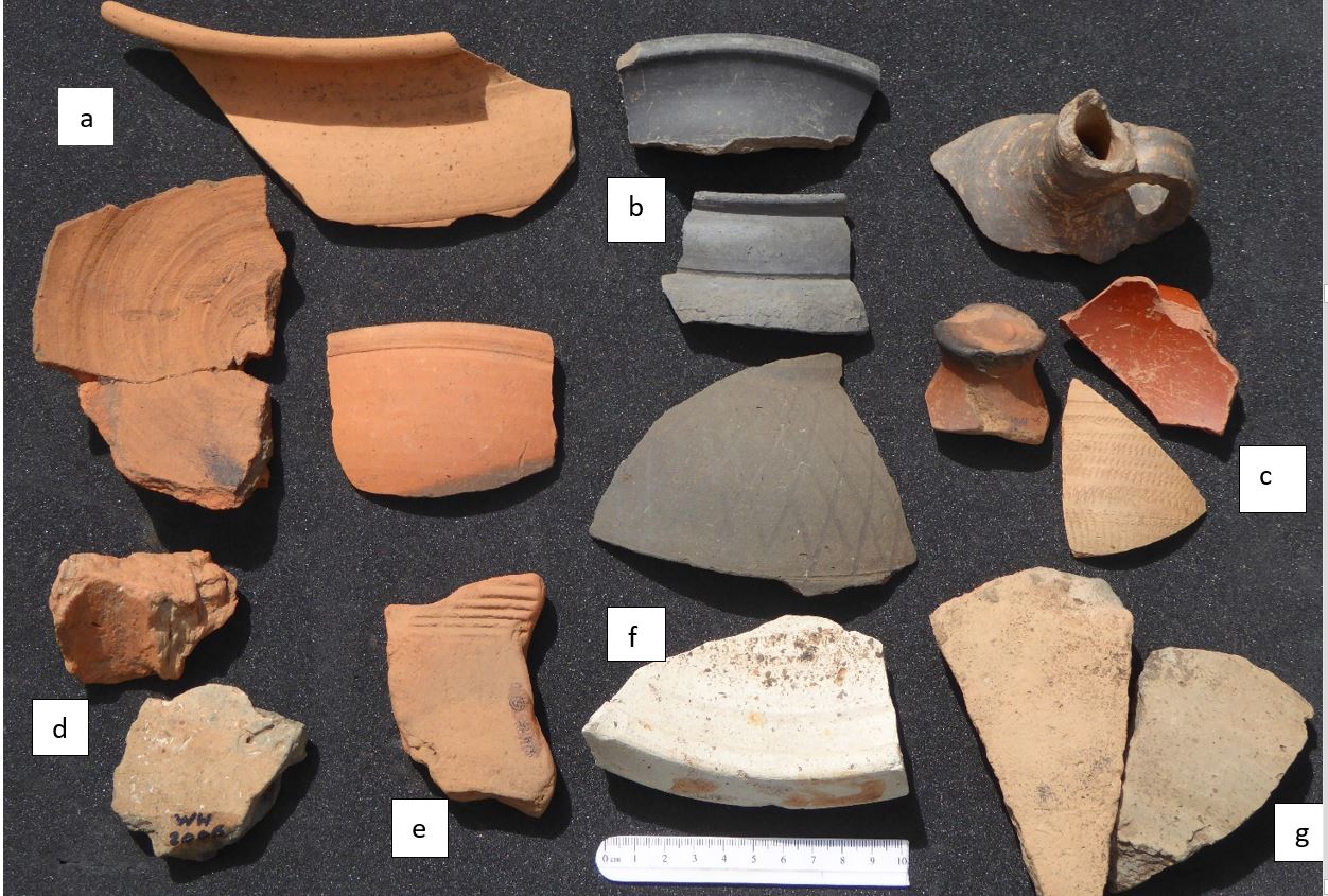
Fig 8 Romano-British & Iron Age pottery from Windmill hill, mainly cooking and table ware: a) Severn Valley ware x3, b) greyware decorated bowls and a flagon x4, c) Samian, Oxford colour coated & rouletted ware x3, d) Iron Age daub & pot, e) combed flue tile, f) grit covered mortarium for grinding up sauces x1, g) Spanish olive oil amphora fragments x2.
Metal detectorists have scanned the southern part of Windmill hill and have found pieces from the Roman period which the author was able to photograph. These also paint a similar picture of a moderately successful farm.
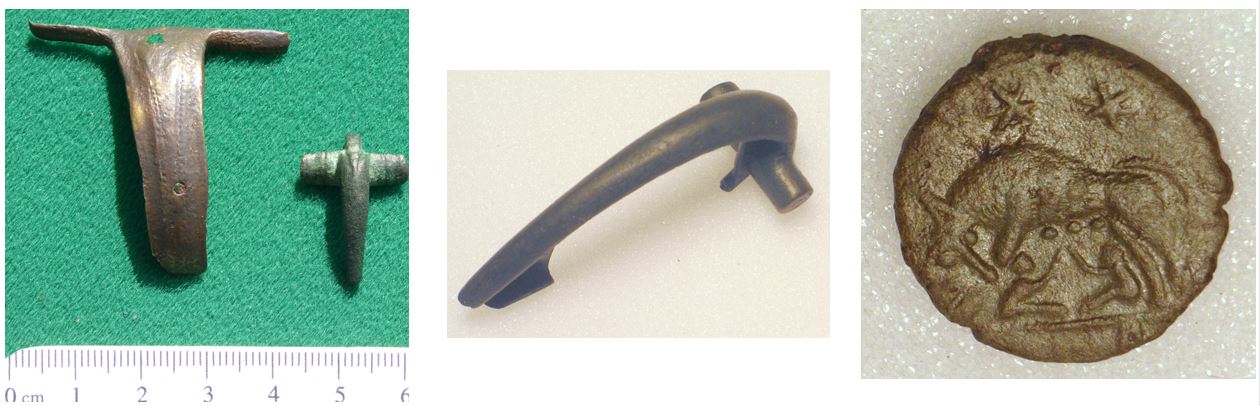
Fig 9 Three early Roman period (1st-2nd C) brooches (Harratt 1989) from Windmill hill.
Right image: back of coin showing the symbol of Rome itself, a wolf suckling the twins Romulus and Remus.
These brooches were used like safety-pins to fasten clothing at the shoulders and were worn by everyone including children, hence the tiny version. All three are from the 1st to 2nd centuries and their styles would have signalled something about the status of the wearer but imperceptible to us.
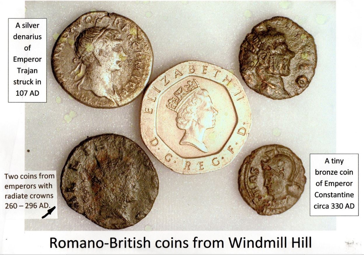
Fig 10 Coins from periods throughout the Roman occupation of Britain. The modern 20p coin shows just how small coins were at this time and so how easily they were lost on Windmill hill.
Coins would have been needed to pay Roman taxes and one of the ways that money was raised by Ilmington farmers at this time was by selling grain, animals and woven cloth (fig 11 & 12).
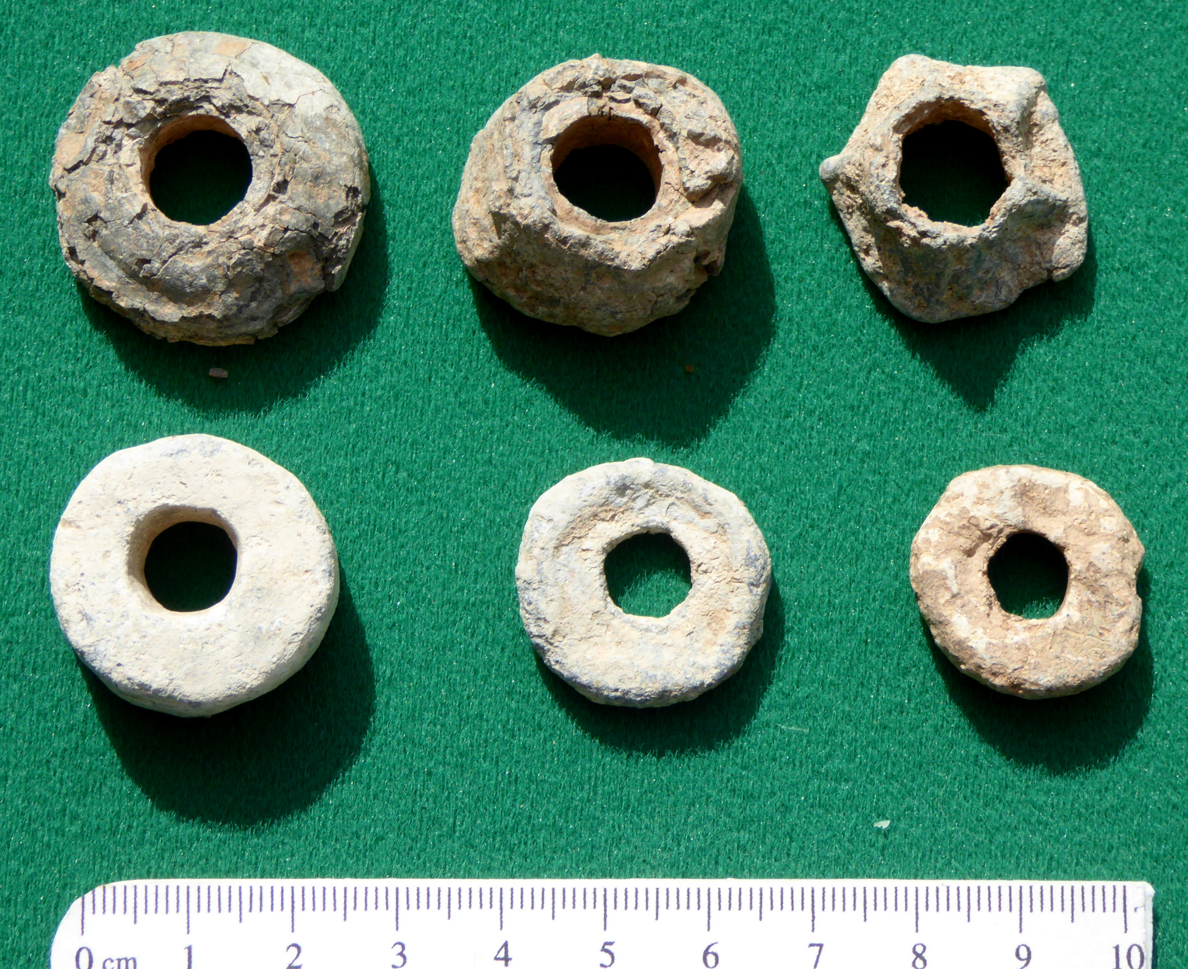
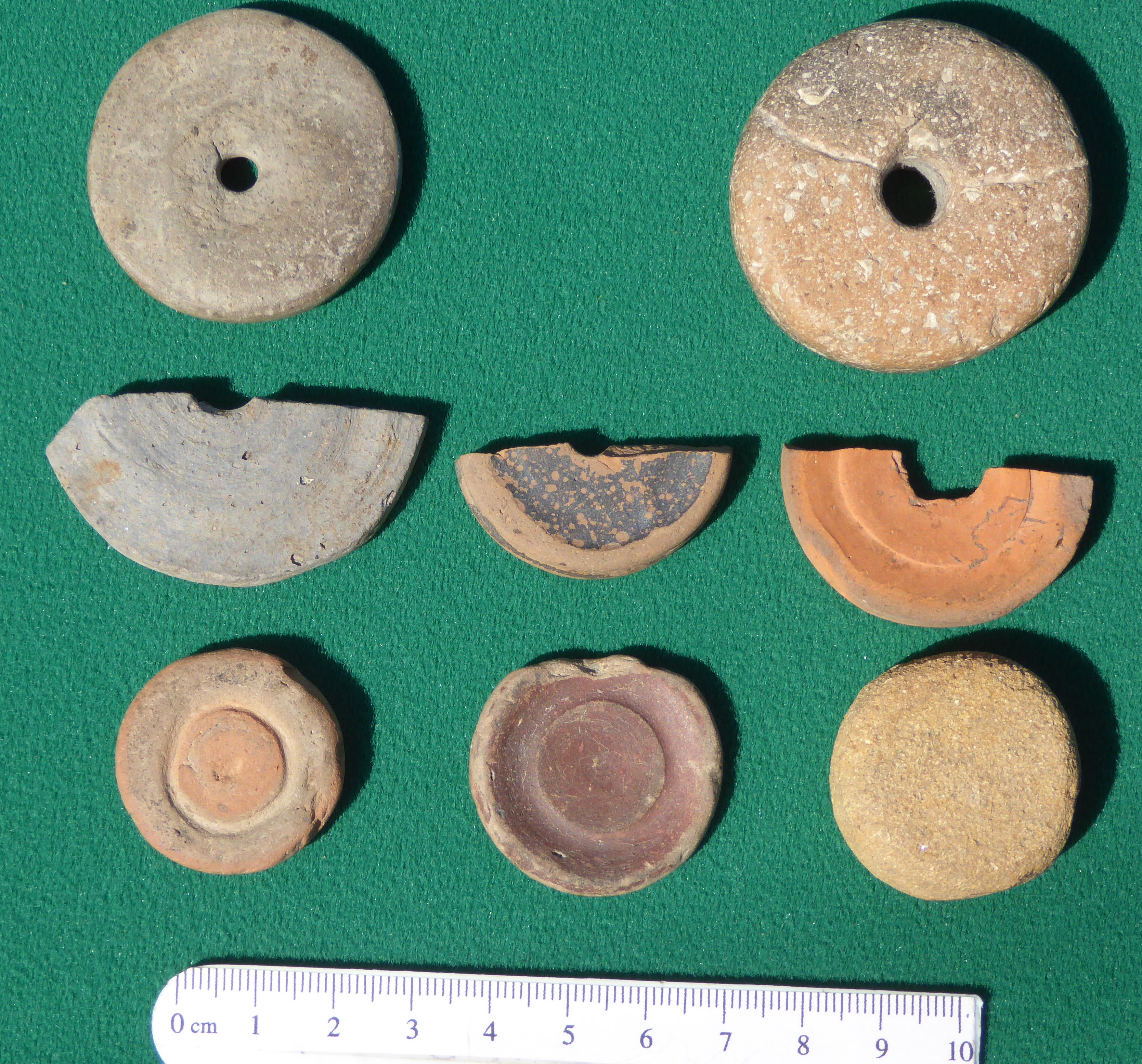
Fig 11 Left: lead spindle whorls from Windmill hill, right: pottery ones from Upper Larkstoke farm
Spindle whorls were used to spin wool into yarn (fig 12) and in the Roman period, lead and recycled pottery were both used to provide the weight driving the rotation of the spindle as it dropped.

Fig 12 Spinning wool into yarn with a spindle whorl.
The rotating spindle twists the wool threads into a length of yarn that is then wound on the wooden shaft of the spindle. The whorl on the bottom causes the spindle to drop, stretches the threads out and keeps the spindle spinning. The skill is to stretch the wool out evenly and keep all things in balance. Not easy.
The lead spindle whorls from Windmill hill were used from Roman times on through the Anglo Saxon period and into the Medieval times. It is difficult to tell which of those in fig 11 belong to which period. However, those shown in the upper two rows of the right-hand image were made from broken pottery sherds and are from the Roman period of the site on Upper Larkstoke. The bottom row are gaming counters also made from broken pots.
The implication from the lead spindle whorls is that spinning in Ilmington was carried on from the Roman period into medieval times. Also that activities in the various Roman period farms around ‘future Ilmington’ were all quite similar. There was a community of individual farms but not a centralised village.
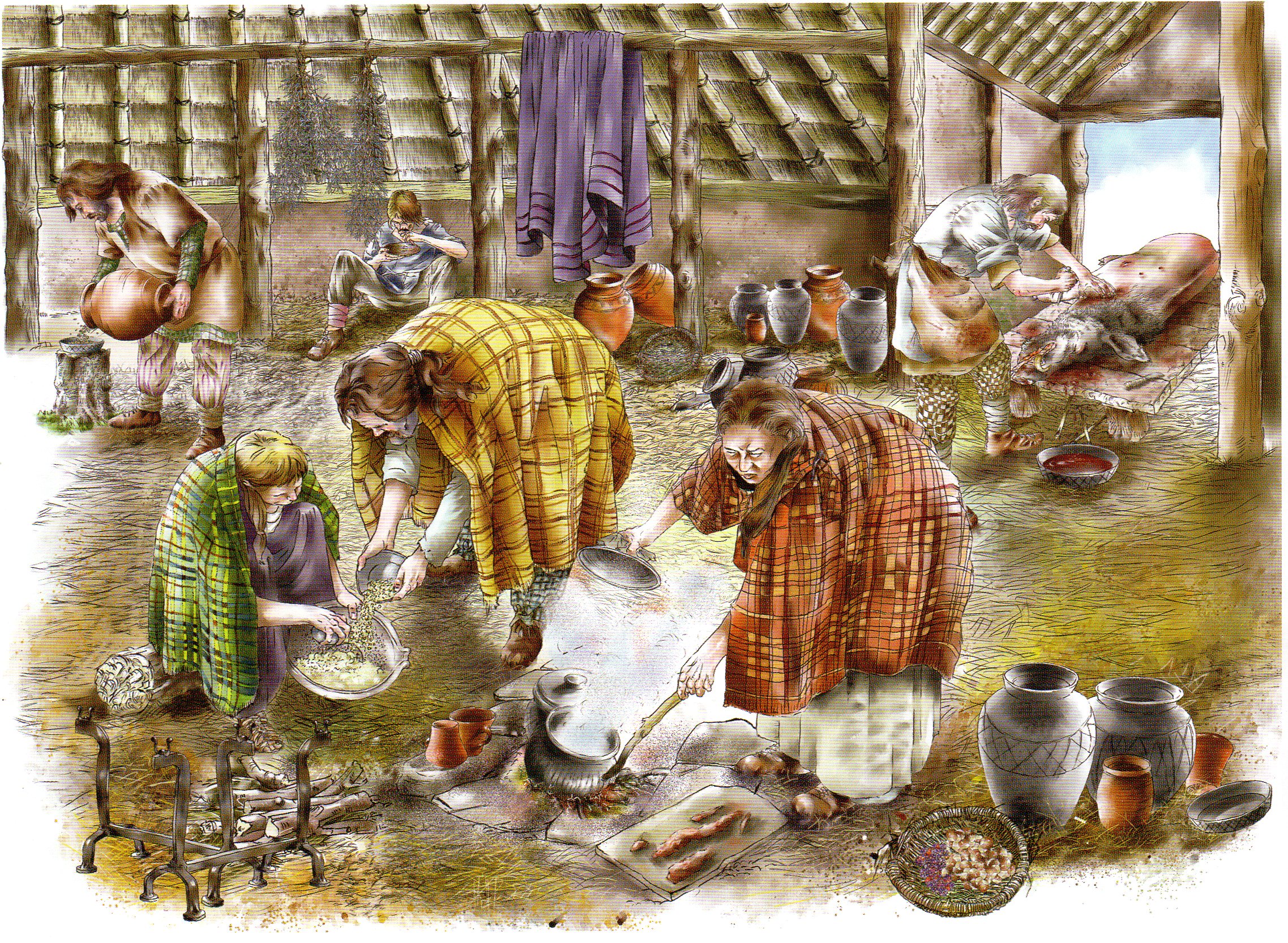
Life on the farm in Roman times.
Reconstruction by Worcestershire Archaeology

Fig 13 Iron Age / Romano British farms (red discs) known to the author from their pottery scatters. From the top: Preston on Stour, Berryfield farm, Meon Hill , Lower Larkstoke, Mansell farm, Windmill hill, Hidcote Bartrim, Upper Larkstoke, Compton Scopion. Ebrington. The red line is the Fosse Way
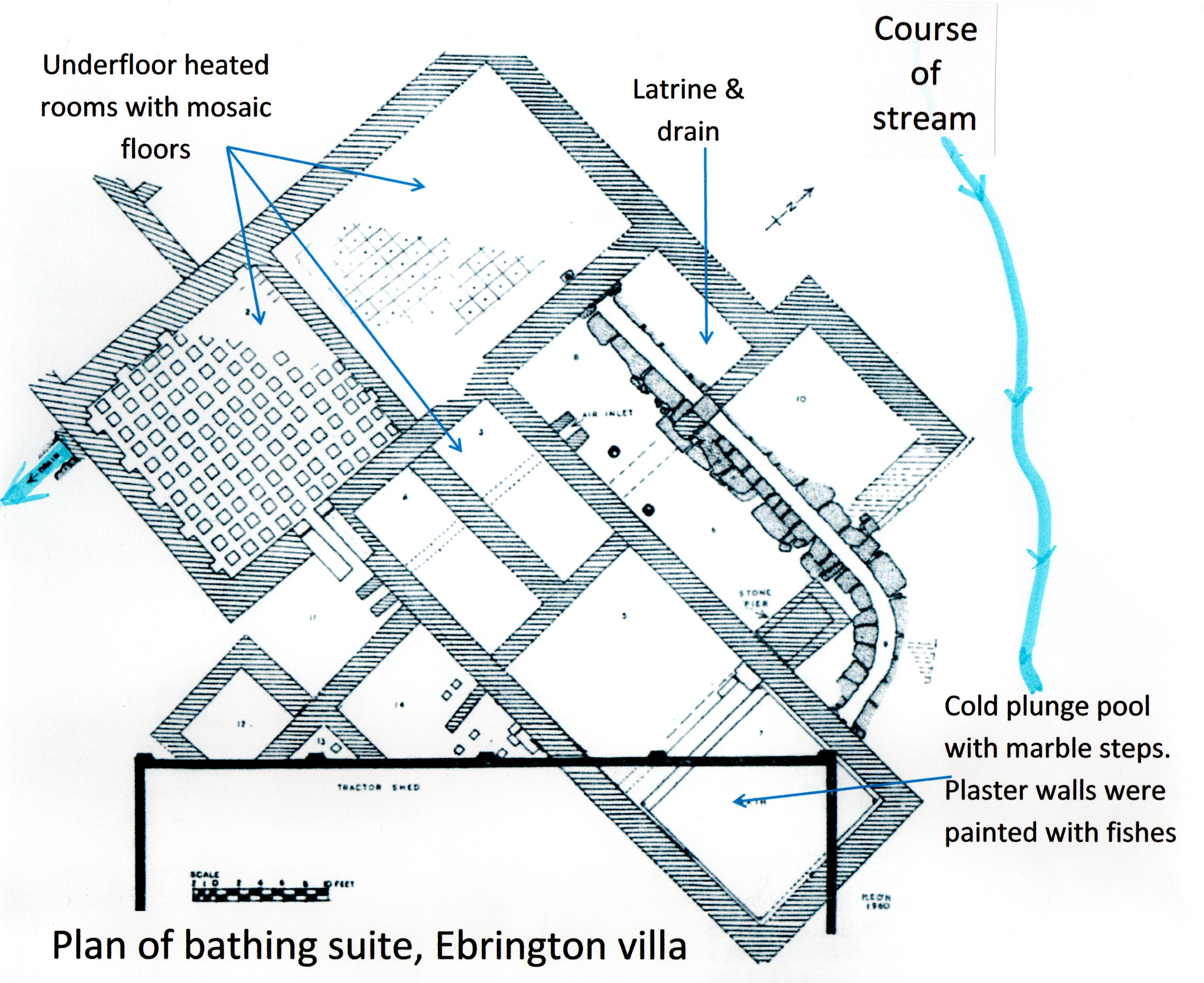
While this report has been about Windmill hill, the farm and its artefacts should not be seen in isolation. There was an entire community of farmers living in the Stour Valley. The local market from which all the Windmill hill pottery came, was at Dorn on the Fosse Way (which acted as the main supply route) and this was also where everybody probably went to pay their taxes to Rome (Timby 1998). This community was centred on the home of the chief family of the Stour Valley clan, the villa site in Ebrington. Mosaic floored bathing facilities have been found there although its full extent has not been excavated. This was where a farmer may have gone to settle disputes and to pay tribute (to get them settled in his favour).
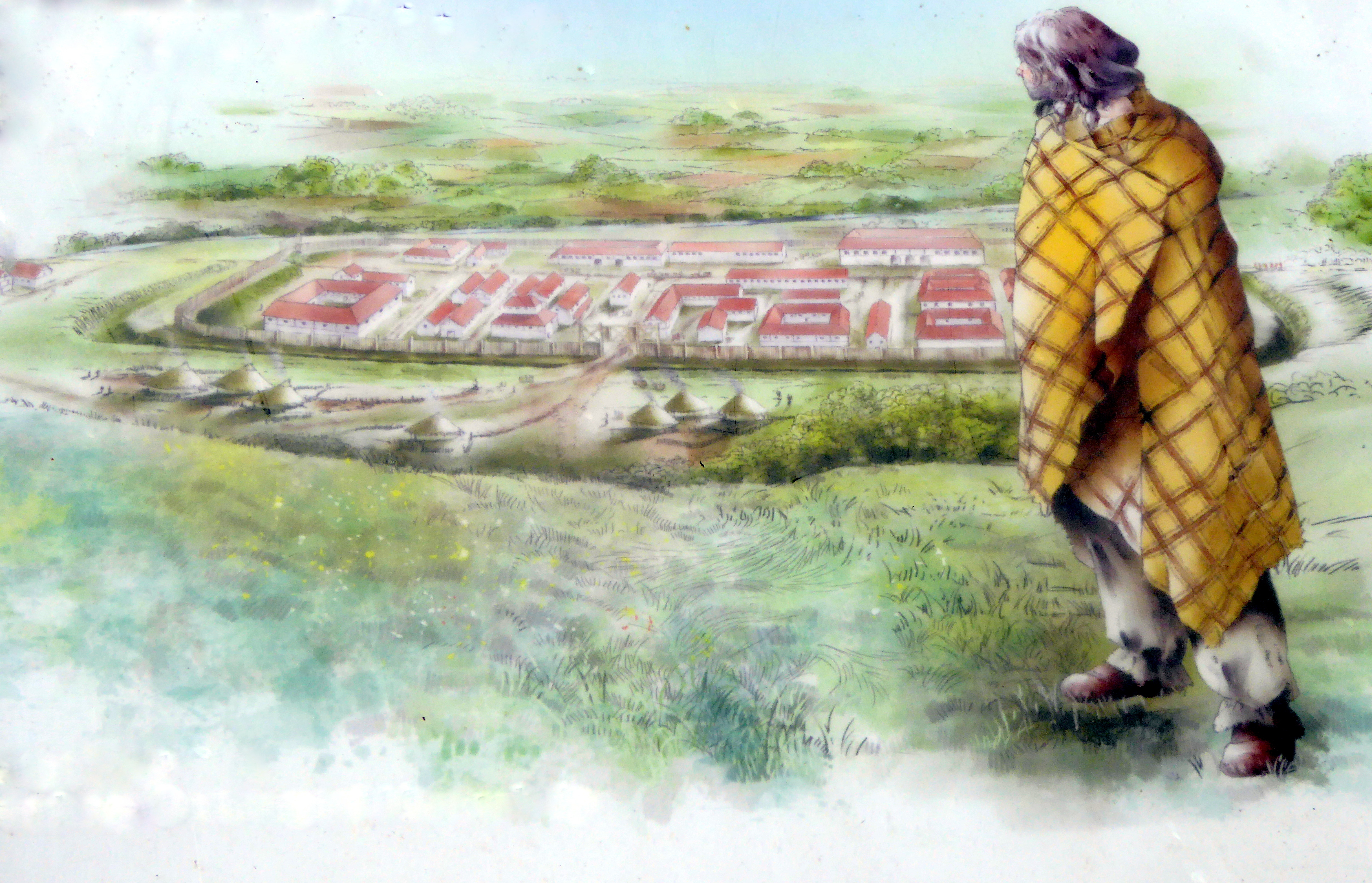
Fig 14 Off to the local market at Dorn, followed by a visit to the local British chief at Ebrington
Medieval (11th -14th C) and Post Medieval (15th – 17th C) Artefacts
In with the Roman period pottery accumulated from the SE field, was a small assemblage of 26 pottery sherds from the medieval and post medieval periods (fig15). These were not part of the 1987 pottery analysis and became another reason for fieldwalking on the SW field when it was ploughed as 26 sherds are not really enough to form a clear view of events. Fig 15a shows Saxo-Norman shelly ware from the end of Anglo-Saxon times, 15b shows splash glazed and colour glazed 12th-14th C pot sherds from the Norman period, 15c is Midlands Black ware from the 16th to 18th C while 15d is 17th to 18th C Staffordshire slip ware. There was no mass-produced 19th C blue transfer ware (such as Willow Pattern) as found in most gardens in the village.
Windmill hill was used as one of the village’s common fields divided into individual strips from late Anglo-Saxon times onwards and that is how the pottery ended up here.
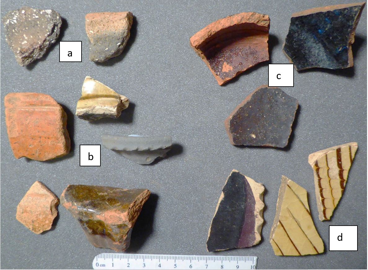
Fig 15 Medieval sherds (a & b) & post medieval (16th-18thC) sherd from SE Windmill hill
From about 900 AD when Ilmington was forming as a village, most people worked strips of land in the communal fields adjacent to the village (figs 3 & 4). To maintain the fertility of their strips and to rid themselves of household rubbish, everyone had a midden on to which went domestic animal waste, holey shoes, old pots, worn out clothing etc. This was spread on their strips of land, usually the closest to home, which in turn meant Windmill Hill Quarter Field (Gardner & Ibbotson 1974, map 2) as this is the field system closest to where most people lived. These strips then retained all the undecayed items from this practice and so carry a history of the village’s life and the village’s beginnings.
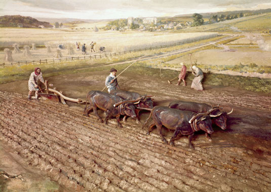
Medieval ploughing required assembling and sharing the use of an oxen plough team, and this practice also depended on people living close together to quickly organise themselves when the soil was in the right condition (often a brief moment for heavy clay soils such as ours) and this in turn may have been one of the reasons for villages to form (Lewis, Mitchell-Fox & Dyer 2001). No one would use the two earliest bits of pot in fig 13a as the only evidence of when Ilmington began, it is a mere indication. This soft, shell-tempered pottery is known as St Neot’s ware has been identified by Paul Booth at sites within the village (Manor Farm Barns and Frog Lane fig 16) and so what can reasonably be said is that it is associated with a period of village formation, for example at Raunds in Northamptonshire and Shapwick in Somerset (Aston & Gerrard 2013) and now, Windmill hill.
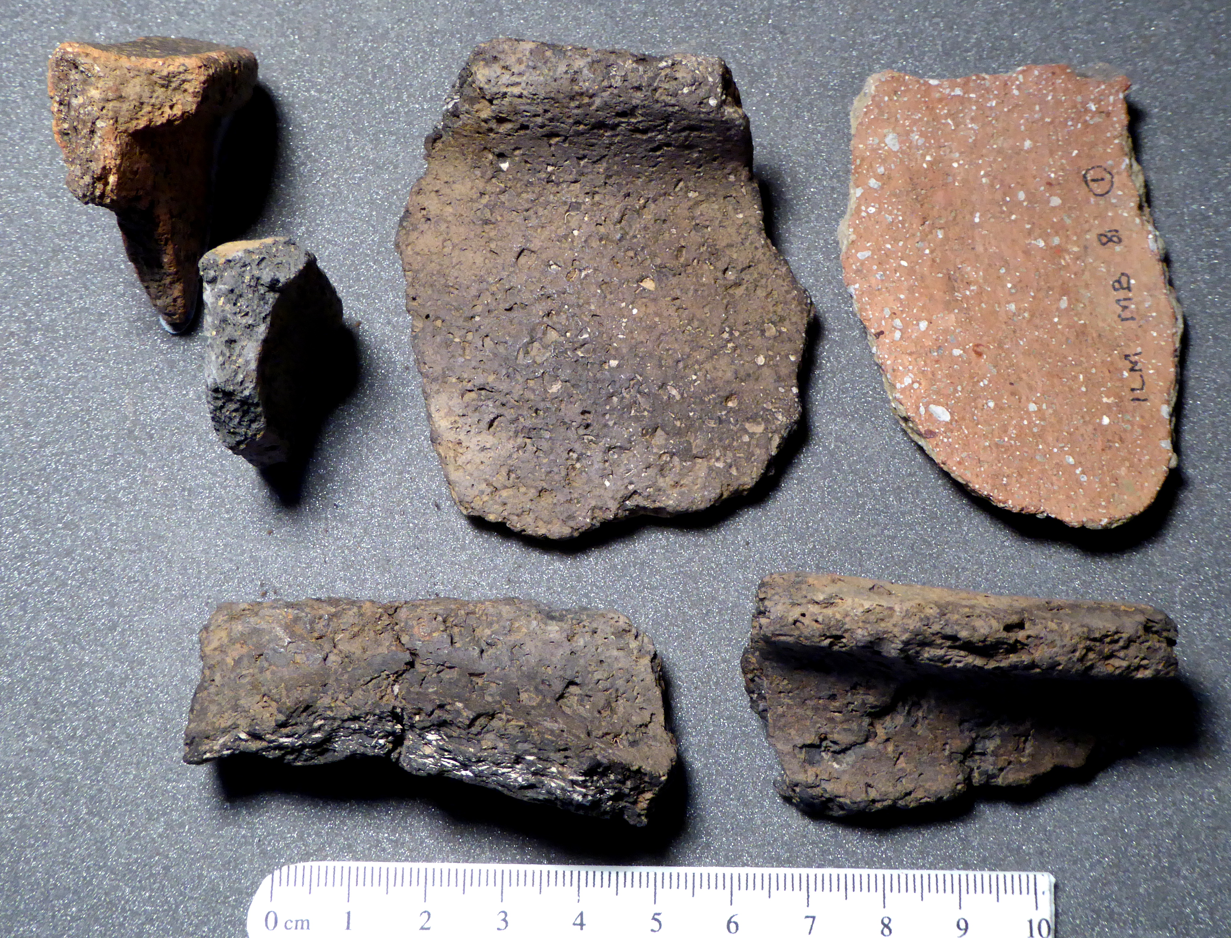
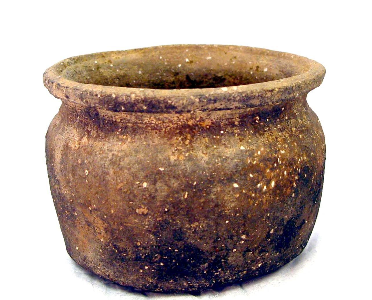
Fig 16 Left: St Neot’s and other Saxo-Norman shelly ware cooking pot fragments from Manor Farm Barns & Frog Lane in the village. The white pieces of fossil shell in the pottery dissolve in rainwater to leave visible pits on the pot surface. Right: a complete Saxo-Norman cooking pot. Below: Medieval glazed pots
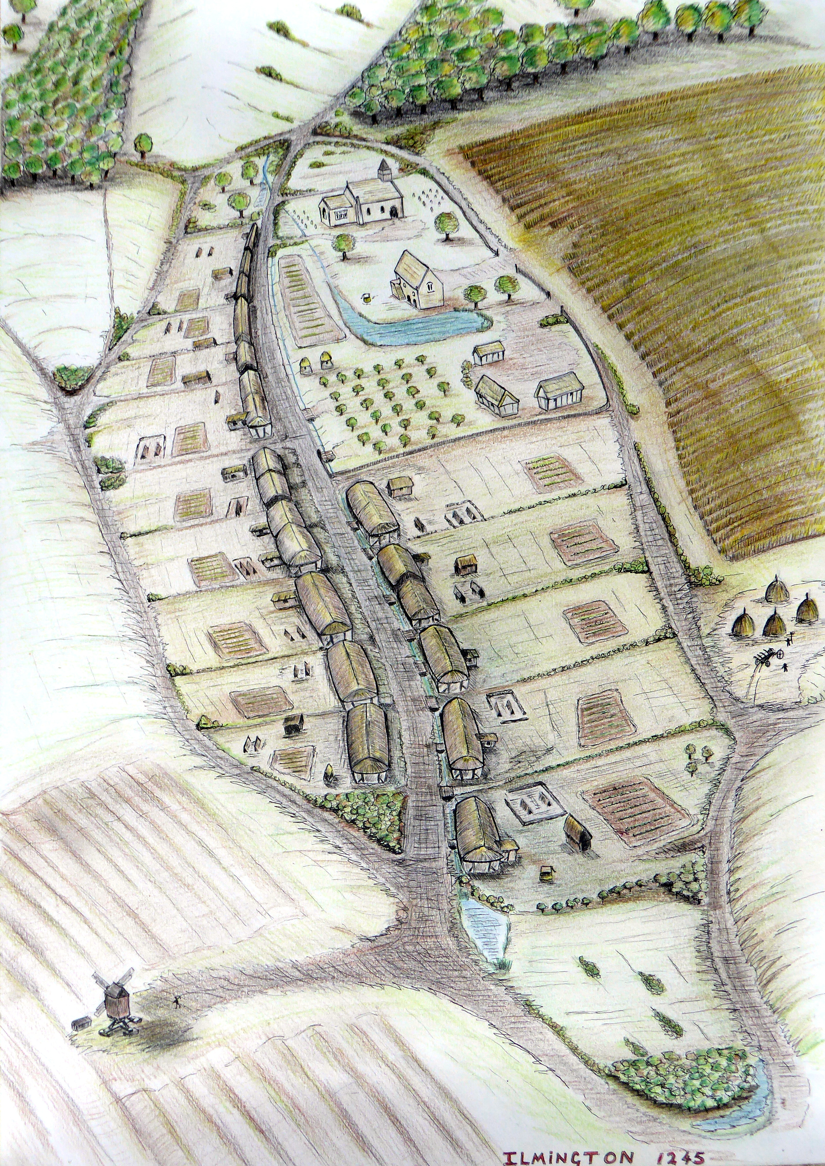
An impression of Medieval Ilmington (1245) looking south to Campden hill by Steve Prosser. The village was centred on Middle Street (continuing beyond its current end at Bevingtons) and dominated by the moated manorial enclave in Bury Orchard
A metal detectors’ unsorted assemblage in fig 17 gives an impression of the villages’ metal rubbish.
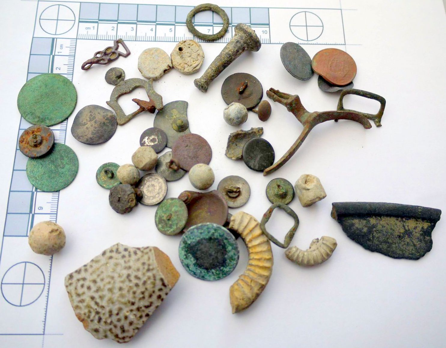
Fig 17 Windmill hill metal finds, all post-medieval: top left = dress hook 1500-1600. Centre right: bent Rowel spur (17th C). Musket shot x4. Belted bullets x2. Flat metal buttons (late 18th C) x16. Broken buckles x3. Lead tokens x2. Penny / halfpenny x3. Fossil ammonite x2. Pottery sherds x2. Identification from Leahy & Lewis 2018.
There were two interesting metal assemblages from the detectorists: lead shot and lead weights:
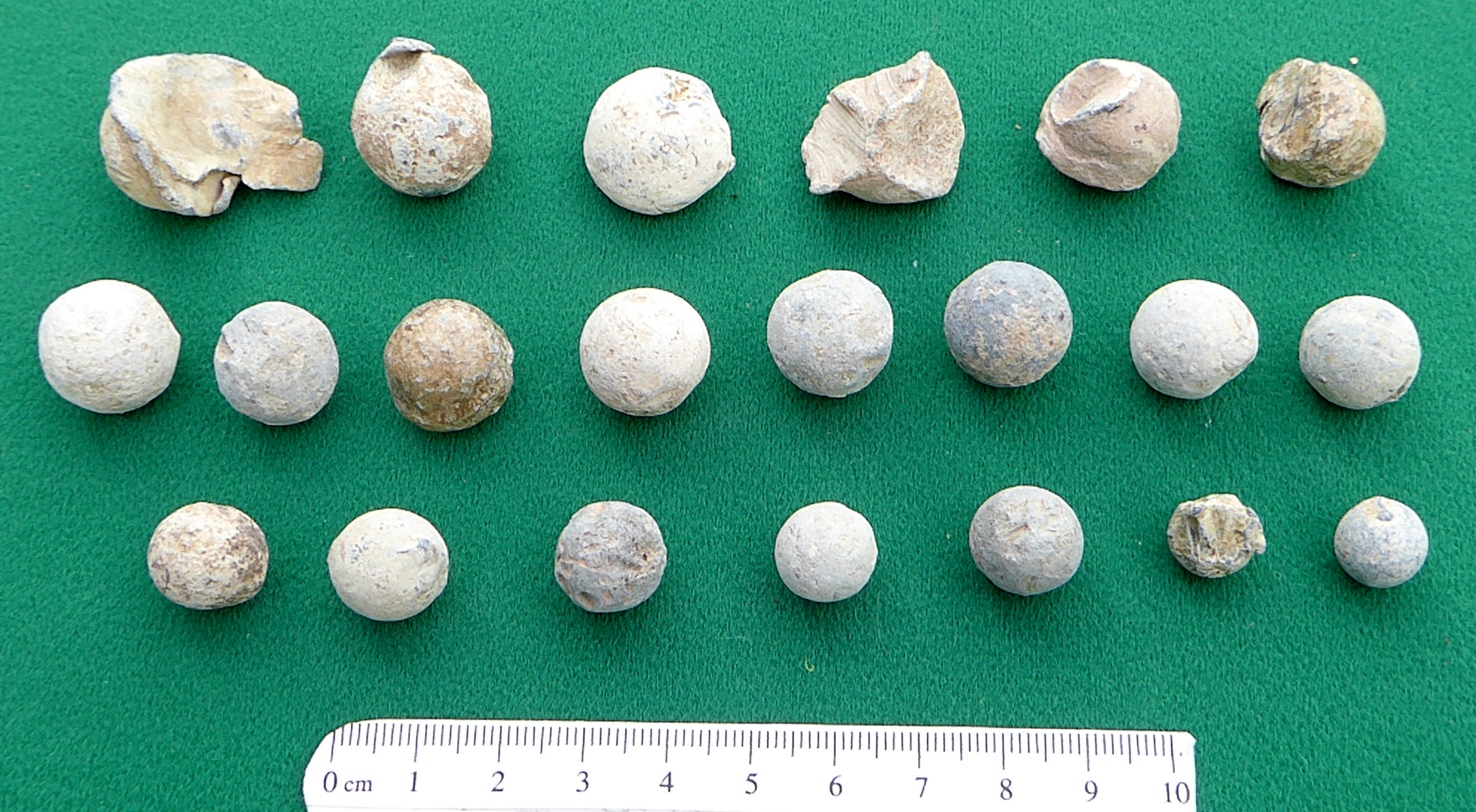
Fig 18 lead shot. Top row; fired & damaged musket balls. Middle row; slightly or undamaged musket balls some with casting marks indicating they were never fired. Bottom row; pistol shot.
It is known that fighting took place in Ilmington during the civil war (Tennant 1996). On Sunday 28th May 1643 there was a skirmish near Ilmington with a dozen Cavaliers killed resulting in indiscriminate looting of the village by Cavaliers from Chipping Campden seeking revenge (Wilson 2007). Parliamentary casualties are unknown but Potter (1910) reports that Ilmington parish register records the burial of two troops on the 28th May 1643. It is not possible to directly connect the lead shot with this incident as there was another at Lower Larkstoke on 8th February 1645 and at least three years of troops from both sides skirmished and stole animals and food in and around the Stour Valley before and after the battles of Edgehill and Cropredy Bridge. However, when troops were fighting in the village, Windmill hill and the windmill (if it was there), would have been one of the few places to give shelter with a height advantage.
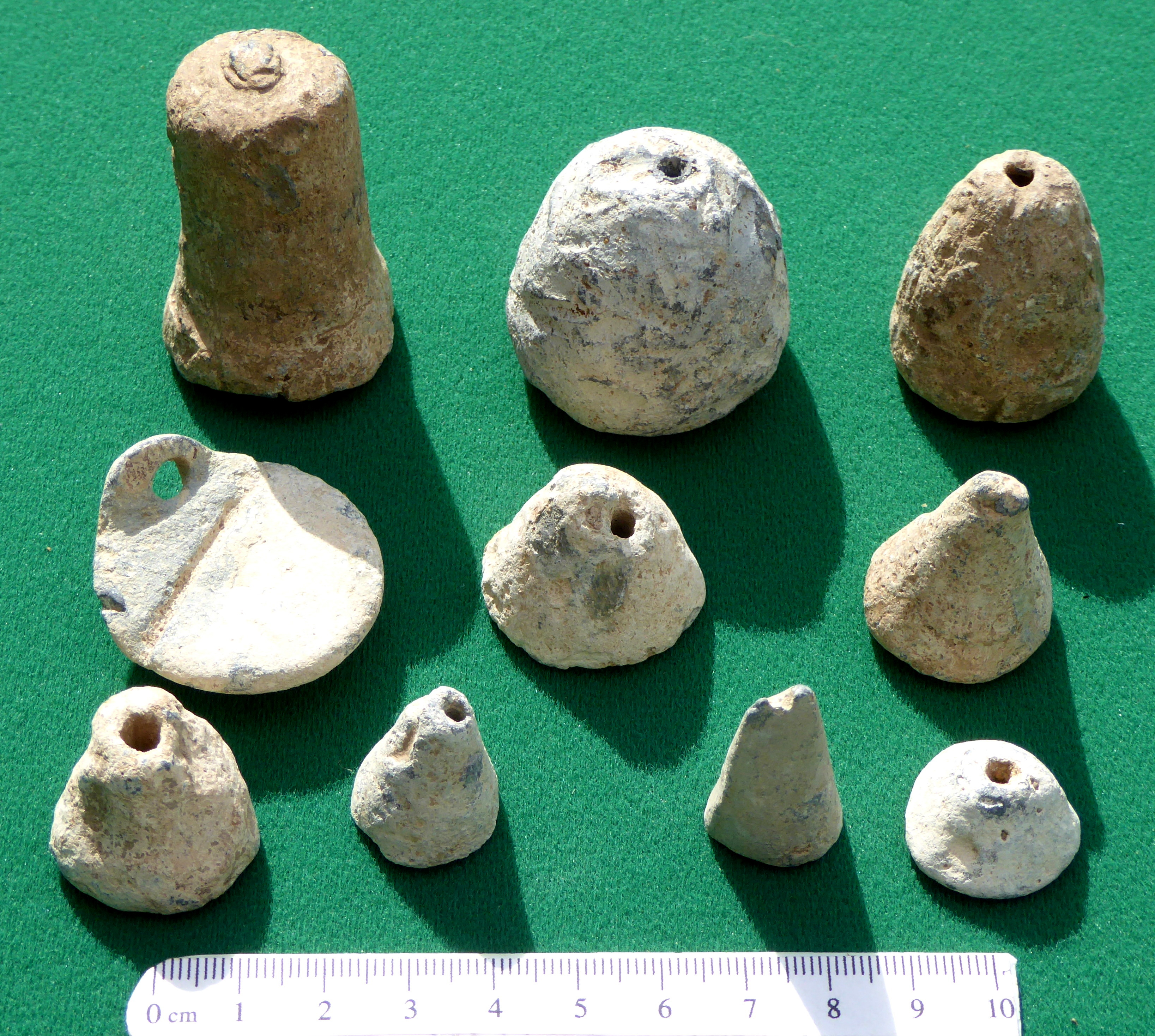
Fig 19 perforated or looped lead weights.
The conical lead pieces of fig 19 are of a type often detected and described simply as ‘conical weights’ of no particular period. They also look like they might be fishing line sinkers, small loom weights for weaving a small fine piece, or a lead group collected to be melted into other things. It is not known where they were found on Windmill hill or if they were all together or dispersed. So, they remain an enigma for the future.
Results of Fieldwalking on the SW Section of Windmill Hill 2020
The area walked in November covered the upper part of the SW field, approximately 150 X 120m (fig 1). Only 51 sherds were found so this was not a dense scatter and not as dense as the SE section which had so much Roman pottery. Particular attention was paid to the area adjacent to the probable location of the windmill but nothing exceptional was found on the surface.
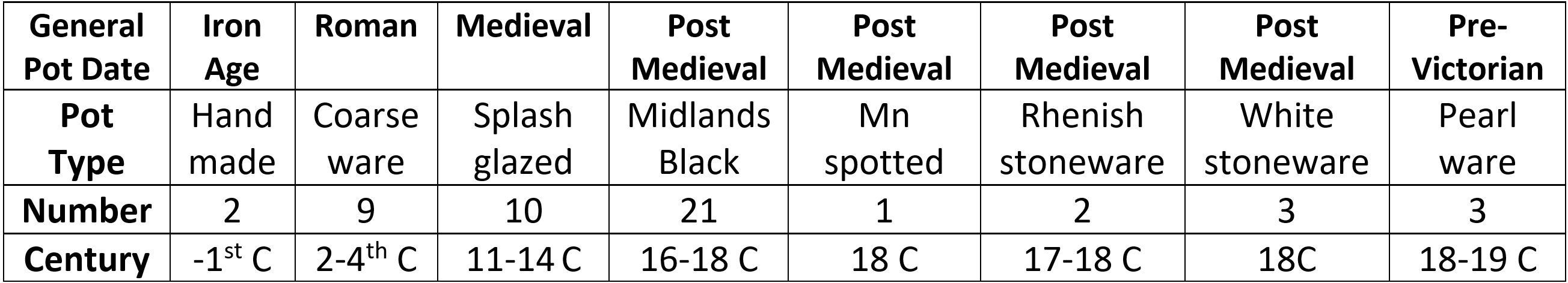

Fig 20 Pottery from SW Windmill hill. 20a: medieval 12-14th C splash glazed ware, 20b: Midland Black ware 16-18th C, 20c: imported Rhenish stoneware 16-17th C (found by Nigel Dunn), 20d: White salt-glazed stoneware 18th C, 20e: Manganese spotted ware 18th C, 20f: Pearlware 18-19th C (Draper 2001, Lang 2003)


Fig 21 Left: examples of Midlands Black mugs. The yellow one is a Midlands Yellow mug of the same period. A sherd of this has been found on the adjacent Littleton hill. The right-hand mug is Rhenish Stoneware from Cologne. The AR in the medallion is for ‘Anne Regina’ i.e. Queen Anne (1702-14).
The pottery table shows that 31 out of a total of 51 sherds collected were from the post Medieval period. That is 61% and of the sherds, and of that, almost 70 % is Midlands Black ware with a fabric that varied from grey/purple to buff pink. This was widely made across the Midland from Chilvers Coton in Warwickshire (near Nuneaton) to Ticknall in Derbyshire and Burslam in the Potteries (Brears 1971). The thick treacly glaze was made from lead oxide with added iron oxide to make it very black and glossy. It was inexpensive and popular because it replaced the wooden bowls used in the Medieval period for drinking and which would have been really rough on the lips (see below right). Midlands Black ware was made into handled cups, mugs, jars and chamber pots and was made (under a variety of names) from 1450 to about 1850 so is difficult to date precisely. The identifiable pieces from Windmill hill were small jars with the curved shouldered bases common in the 16th and 17th centuries and so was also the daily pottery used in the civil war. The two pieces of expensively imported Rhenish ware give tight dates. The purple/brown and blue glazed one is from 1650-1700 and the one with the crown medallion is of the Queen Anne period 1702-14.
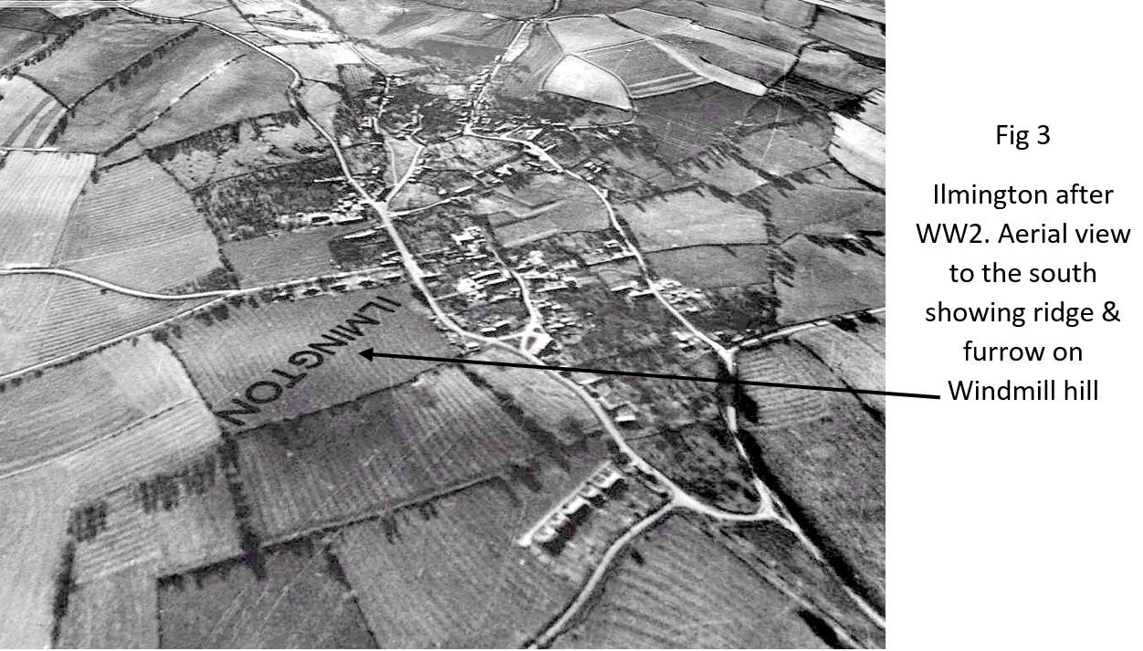
The surprise from the fieldwalking is that there are no pieces of the Victorian pottery which can be found everywhere in the village along with broken Victorian clay pipe stems after tobacco had become affordable. Only 2 pipe stem fragments were found on Windmill hill. So, it would seem that the field was used for crop production from prehistory (Iron Age) through the Roman period and into Anglo-Saxon times, throughout the Medieval period and on until the 18th century when it was enclosed by the hedges that many people think of as natural to the British countryside since time immemorial. After 1781, the hill seems to have been grassed until the ridge & furrow was ploughed flat and then grassed again until this year.
Brian Meredith December 2020
PLEASE NOTE: The field described is private property. Permission should be sought from the landowner before field-walking etc.
Medieval Windmill hill, before hedges

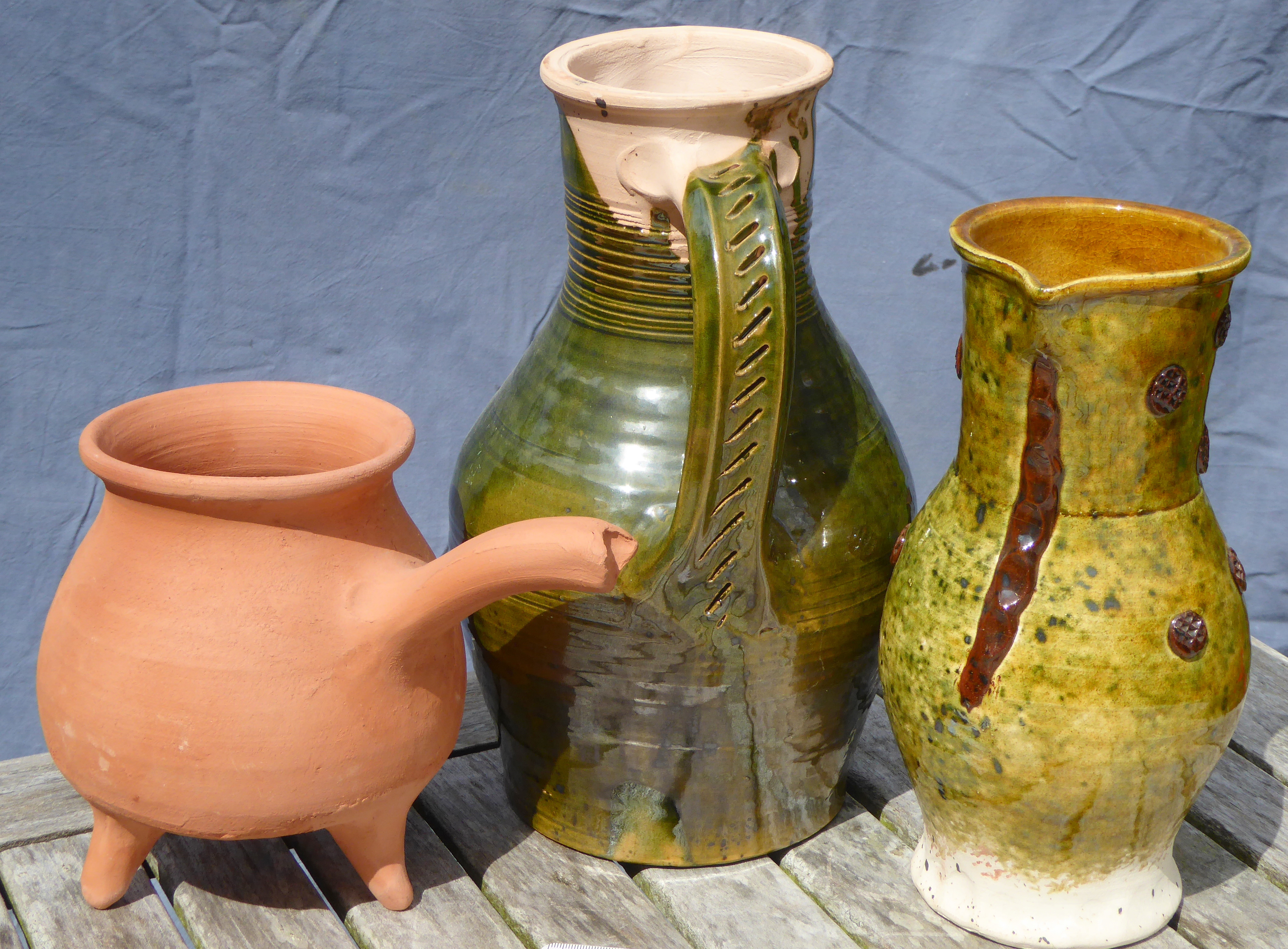
Anglo Saxon & Medieval table ware.
Everything you need for eating & drinking.
References
Aston, M. & Gerrard, C. (2013) Interpreting the English Village: Landscape & Community at Shapwick, Somerset. Windgatherer Press.
Blair, J. (2018) Building Anglo-Saxon England. Princeton University Press.
Booth, P. (1987) Pottery Report from Ilmington Warwickshire. Unpublished internal report, Warwick Museum.
Brears, P.C.D. (1971) The English Country Pottery: its History and Techniques. David & Charles
Carey G. (2014) Fluxgate Gradiometer Survey, Rear of Washbrook Place Ilmington. Geophysical Report. Unpublished internal report, Archaeology Warwickshire
Draper, J. (2001) Post Medieval Pottery 1650-1800 Sire Publications
Dyer, C. (2012) A Country Merchant, 1496-1520: Trading and Farming at the End of the Middle Ages. Oxford University Press.
Gardner, S. M. & Ibbotson, E,M.H. (1974) The History of Ilmington. TUEXpress Oxford
Hattatt, R. (1989) A Visual Catalogue of Richard Hattatt’s Ancient Brooches. Oxbow Books.
Lang, L. (2003) Pottery in Britain: 4000BC to AD 1900. A Guide to Identifying Pot Sherds. Greenlight Publishing
Leahy,K. & Lewis, M. (2018) Finds Identified: an illustrated guide to metal detecting and archaeological finds. Greenlight Publishing.
Lewis, C. Mitchell-Fox, P. & Dyer, C. (2001) Village Hamlet and Field: Changing Medieval Settlements in Central England. Windgatherer Press.
Millward, R. & Robinson, A. (1971) Landscapes of Britain: the West Midlands. MacMillan.
Moore, T (2006) Iron Age Societies in the Severn-Cotswolds: Developing narratives of social & landscape change. BAR British Series 421 .
Potter, F.S. (1910) Ilmington: Some Collections Touching the History & Antiquities of the Parish and Some Gossip about the Traditions and Folk Lore, by an Old Native. Ed E.M.H. Ibbotson
Tennant, P. (1996) Chipping Campden and its District in the Civil War. Campden & District Historical & Archaeological Society Notes & Queries Vol 1 Nos 5 & 6.
Timby, J. (1998) Excavations at Kingscote and Wycomb, Gloucestershire. Cotswold Archaeology Trust Ltd.
Wilson, J. (2007) I Marched Straight To Campden: the Story of Chipping Campden during the Civil Wars 1642-1651. Campden & District Historical & Archaeological Society